

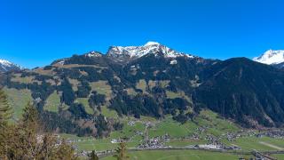

Zillertal Valley Trail (Zillertaler Höhenweg)
High-altitude trail through the Zillertal Alps
- Where
- Mayrhofen, Tyrol
- Directions
- Directions
The Zillertal Alps rise along the border between Tyrol and South Tyrol, and the high-level routes through them are among the classic long-distance walks of the Eastern Alps. The Zillertaler Höhenweg belongs to this tradition of hut-to-hut walking, linking mountain huts run by alpine clubs at altitudes where meadows give way to rock, snowfields and the edges of glaciers. Mayrhofen, the main village at the head of the Zillertal, is the usual starting point for exploring the area, and from here several lifts and valley roads lead up to the higher routes.
This is a trail for experienced mountain walkers. The paths run well above the treeline, often at around two thousand metres or more, and cross steep slopes, boulder fields and, in places, patches of old snow that can linger well into summer. Route finding is helped by clear markings, but weather can change quickly, and mist, thunderstorms and cold winds are real hazards even in July. Good boots, rain gear, warm layers and a map are essential, and it is wise to start early to avoid afternoon storms.
The reward is scenery on a grand scale. Walkers pass high meadows with grazing animals and alpine flowers, then climb to ridges with views across the Zillertal to peaks that carry glaciers. The Schlegeis Reservoir lies in a side valley, its water a milky turquoise from glacial meltwater, and it adds a bright note to the landscape. Along the way, mountain huts offer meals, drinks and beds, and a stay in one is part of the experience, with long evenings, hearty food and conversation among walkers from many countries. Reserve beds ahead in the summer months, as the huts can be busy.
To reduce the initial climb, hikers often use cable cars such as the Ahornbahn at Mayrhofen, which lifts walkers directly to higher ground. The Penkenbahn on the other side of the valley also opens routes to high pastures and ridges, and both lifts are helpful for those planning shorter day walks in the same terrain. Mayrhofen itself offers accommodation, shops, restaurants and a parish church dedicated to Saints Peter and Paul.
The main hiking season runs from early summer to early autumn, depending on snow, and conditions vary from year to year. Check with the local tourist office or the alpine club about the state of the paths before setting out. The trail suits fit walkers with some mountain experience who want a few days among big peaks, and less ambitious visitors can sample shorter sections from the cable car stations.
Categories

More photos coming soon
Nearby Attractions
Other places to visit in Mayrhofen
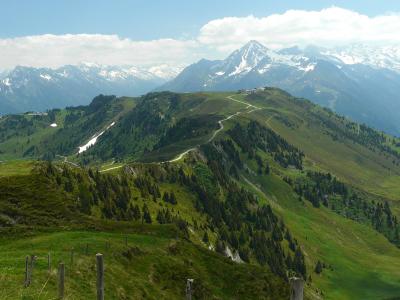
Zillertal Bahnen (Penken-Arenberg Cable Car)
Modern tricable gondola to 1,790m
From €25.50 Adventure & Activities · Cable Cars

St. Peter and Paul Church
Baroque church in Mayrhofen, Austria
Architectural Highlights · Historic Houses

Penkenbahn
Modern cable car to Mayrhofen's Harakiri slope
Cable Cars · Mountain Hiking
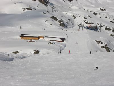
Zillertal Arena Ski Area
Largest connected ski area in Zillertal
From €82 Mountain Hiking · Ski Resorts
Questions people ask
Quick Facts
Best Time to Visit
Austria enjoys a Mediterranean climate with warm summers and mild winters, making it ideal for visiting year-round.